Coventry Ring Road:
Route map

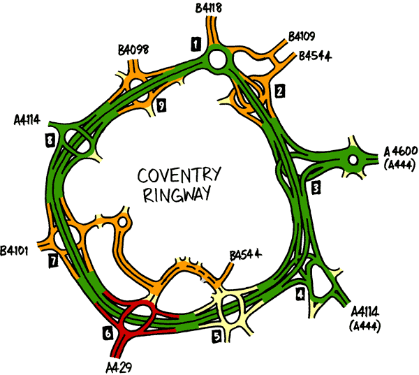
This map shows the route of the Ring Road, not perfectly to scale but accurately enough to demonstrate the size of its junctions in comparison to the spaces between them. It also includes a couple of roads inside the ring to demonstrate just how tightly the road is drawn around the city centre.

The route of the Coventry Ring Road. Click to enlarge

In this section

What's new

Farewell GLC lights

Why am I all nostalgic about some street lights being replaced?

Silver bullet

The Silvertown Tunnel is finally open for business. One question remains: what’s it for?

Skid Risk, Accident, Fog

For the first time, we can share pictures of the pioneering experiment that lit up the Worcestershire countryside with enormous signs 61 years ago.

Share this page

Have you seen...

All of the A6118

A peculiar road near Peterborough with an interesting history. And it's only a mile long.

About this page

Published

Last updated