This page is about abandoned proposals to incorporate the M1 into an urban motorway network for London. Information about the motorway as it exists today is in the Motorway Database.
Everyone knows the M1: it's the main road north from London, the way to the Midlands and the North. Today it's missing the connections that would have integrated it with London's urban motorways.
Planning for the M1 was in full swing during the 1950s, and in the early days its planners were hopeful that they could make a truly urban motorway for London, penetrating right into the centre to terminate on the Arterial "A" Ring at Marble Arch. That plan did not last long.
What replaced it was a more realistic plan, benefitting hugely from occupying a corridor through north west London that was either free from development or ran alongside a railway where land was easily cleared. Because the obstacles were few, an early start could be made, which meant that much of the road was built before London's motorways ever became political.

Indeed, the only parts of the M1 that remain unbuilt are two short links. One would have joined it to the A1 at Stirling Corner, and is explored as part of the A1 and A1(M); the other is the motorway's extension south from its terminus on the A406 North Circular Road at Staples Corner to reach Ringway 1's North Cross Route at Kilburn.
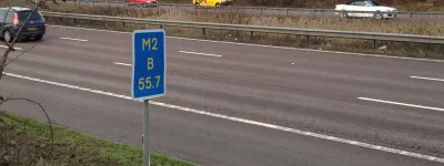
Included on this page, as part of the M1's route, is the connection from the M1 to Ringway 3's Northern Section that was formed by the M10 and A6. This route branches off the M1 near St Albans and would have been improved to form a continuous high-speed connection for traffic to cut the corner between the two motorways.
Outline itinerary
![]() Continues to Luton and Milton Keynes
Continues to Luton and Milton Keynes
![]() A414 Breakspear Way (Breakspears Interchange)
A414 Breakspear Way (Breakspears Interchange)
![]() M10 leading to A6 (Beechtrees Interchange)
M10 leading to A6 (Beechtrees Interchange)
![]() Ringway 4 North Orbital Road (Bricket Wood Interchange)
Ringway 4 North Orbital Road (Bricket Wood Interchange)
![]() A41 North Western Avenue (Berrygrove Interchange)
A41 North Western Avenue (Berrygrove Interchange)
![]() Ringway 3 Western Section (Bushey Interchange)
Ringway 3 Western Section (Bushey Interchange)
![]() A41 Watford Bypass (Brockley Interchange)
A41 Watford Bypass (Brockley Interchange)
![]() A1 Barnet Bypass (Scratchwood Interchange)
A1 Barnet Bypass (Scratchwood Interchange)
![]() A1 Great North Way (Fiveways Interchange)
A1 Great North Way (Fiveways Interchange)
![]() Ringway 2 North Circular Road (Staples Corner Interchange)
Ringway 2 North Circular Road (Staples Corner Interchange)
![]() Ringway 1 North Cross Route (Kilburn Interchange)
Ringway 1 North Cross Route (Kilburn Interchange)
Cost summary
These figures only cover the unbuilt section of the M1, between the Ringway 1 North Cross Route and Ringway 2 North Circular Road.
| Property acquisition (1970) | £7,000,000 |
| Rehousing (1970) | £3,600,000 |
| Construction (1970) | £18,200,000 |
| Environmental works (1970) | £210,000 |
| Total cost at 1970 prices | £29,010,000 |
| Estimated equivalent at 2014 prices Based on RPI and property price inflation |
£451,757,165 |
See the full costs of all Ringways schemes on the Cost Estimates page.
Route map
Scroll this map to see the whole route
Scroll this map vertically to see the whole route
Key to map symbols
| "Primary Road" Network | |
|---|---|
| Primary Road | |
| Primary Road section in tunnel | |
| Primary Road approximate or assumed line | |
| Primary Road cancelled or deleted before start of GLDP Inquiry | |
| "Secondary Road" Network | |
| Secondary Road single carriageway or of unknown formation | |
| Secondary Road known to be dual carriageway | |
| Secondary Road section in tunnel | |
| Junctions | |
| Location of Primary Road junction where layout is not known | |
| Location of Secondary Road junction where layout is not known | |
| Location of a junction cancelled or deleted before start of GLDP Inquiry where layout is not known | |
Route description
This description begins at the southern end of the route and travels north.
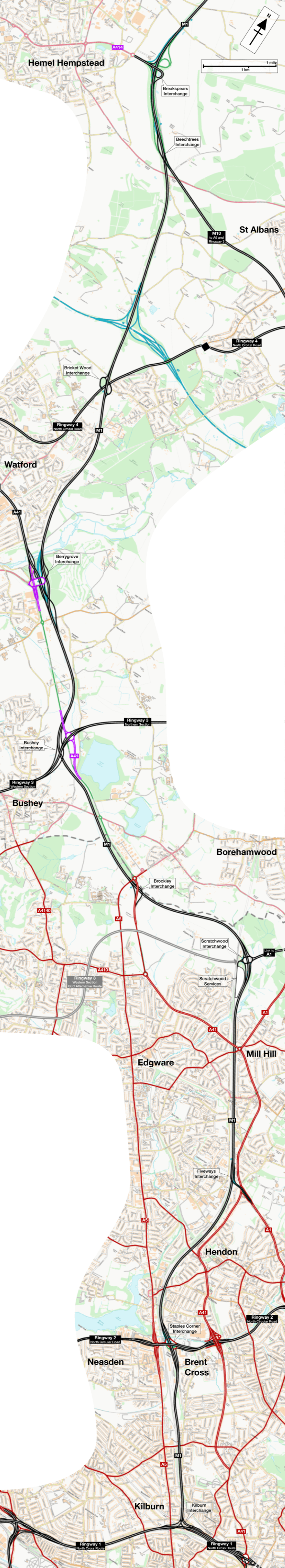
M1, Kilburn to St Albans
Starting at a free-flowing interchange on the Ringway 1 North Cross Route in Kilburn, with connecting sliproads from the A41 Finchley Road, the M1 would travel north along the east side of the Midland Main Line railway.
A relatively straight course would carry it to the Ringway 2 North Circular Road, where a three-level stacked roundabout junction - the middle of three along the North Circular, serving the A5, M1 and A41 respectively - would provide connections east and west.
North from this point the motorway exists today except for a couple of missing junctions. Continuing to follow the east side of the railway, a north-facing junction links to the London-bound A1, followed by a roundabout interchange at Scratchwood, giving access to Scratchwood Services (now called London Gateway) and the A1 and A1(M) northwards. Between these junctions the M1 would serve as a bypass for the congested A1 through Mill Hill. The motorway then turns west.
Another north-facing junction at Brockley, now M1 junction 4, connects to the A41, and then an unbuilt junction would be located near Bushey with links between the M1 to the north and Ringway 3's Western Section. Turning to travel northwards again, it would be followed by an interchange at Berrygrove, now M1 junction 5, that provides connections to the A41. It's possible that the present Berrygrove Interchange would be rebuilt to provide free-flowing connections between the M1 to the south and the A41 to the north.

Bricket Wood interchange, M1 junction 6, would provide connections to the Ringway 4 North Orbital Road. Improbable as it may seem, its existing form would remain, though it was suggested in the early 1970s that once the present A405 North Orbital Road was overloaded, a bypass of the whole area would be built from west of Hunton Bridge Roundabout to the M1, replacing this junction with another interchange elsewhere.
The next junction is another north-facing interchange, connecting to the M10 (now the A414 at M1 junction 7), which would carry traffic south-east towards Ringway 3's Northern Section and the Ringway 4 North Orbital Road. That route is described separately below. North of the M10, the M1 would continue towards Luton and Milton Keynes.
M10 and A6, South Mimms to St Albans
Branching off Ringway 3's Northern Section at South Mimms, now M25 junction 23, the A6 would pass over the top of the Bignells Corner roundabout and turn north-west along the line of the modern M25. A local interchange with north-facing sliproads would connect to South Mimms village, and the road would fly over the roundabout at The Bell.

Bypassing London Colney to the north, the road would pass through a grade-separated junction with the Ringway 4 North Orbital Road at London Colney Roundabout, turning west to join the A414. The road would be shared with Ringway 4 through to Park Street, where another grade separated junction on the site of the present roundabout would lead on to the M10, now the A414.
The M10 would complete the southern bypass of St Albans, joining the M1 at junction 7.
The forgotten urban motorway
Opened in 1959, the first length of the M1 ran from Watford (present-day junction 5) to Northamptonshire. Through the 1960s the motorway was progressively extended north into Yorkshire. In 1965, work began on a project to also extend it south, further into London.

This first southward extension came in two parts. The first, Berrygrove to Edgwarebury Lane, was entirely rural and brought the motorway south from its Watford terminus to a point just east of junction 4. The second - built in parallel but a different contract - was Brockley to Page Street, the length between junctions 4 and 2.
Ambitions for the M1 had, to begin with, been almost absurdly optimistic. In the era when the motorway was first planned, back in the early 1950s, the London County Council proposed to build the Arterial "A" Ring, leading the Ministry of Transport to think they could bring the M1 right in to Marble Arch. That plan unsurprisingly turned out not to be practical. But the M1 did need to get a lot closer to London.
Its lurch south would take it into suburbia, bypassing the congested A41 between Watford and Fiveways Corner in Hendon. A short spur road, the Scratchwood Link, would allow it to siphon off traffic from the A1 as well. (The spur itself was never built, but is described on the A1 and A1(M) page.) This project was known as the Hendon Urban Motorway.
If you wish to picture a version of London where the Ringways were built - where London's suburbs are home to huge, incongruous motorways; where the alignment of commuter railways are paralleled by multi-lane highways - then all you need do is visit Mill Hill and take a look at the M1.

The Hendon Urban Motorway was straight out of the Ringway template for motorway design. Oddly, though, despite its brutal design, it's virtually forgotten as an urban roadbuilding project.
South of Scratchwood the M1 follows the Midland Main Line railway. Space was cleared through back gardens and homes. At Glendor Gardens, one side of a peaceful cul-de-sac of new semi-detatched houses was demolished, with the remaining homes now overlooking the motorway. At Mill Hill Broadway, the station forecourt, a bus station and a length of shopping street were placed beneath a long and imposing viaduct.
In the scheme's commemorative booklet, the M1's designers sound almost irritated at the requirement to build a retaining wall rather than demolish another row of houses:
"This structure, built on London Clay, presented one of the biggest engineering problems of the whole project... The decision to adopt the construction of a retaining wall seriously complicated both the design and construction of this section of the motorway, but the costs and difficulties were accepted in order to avoid wholesale hardship to residents and destruction of local amenities."
Perhaps the most remarkable feature of the Hendon Urban Motorway, though, is that it attracted no protest.

Built just a few years before roadbuilding in London became the subject of widespread opposition, there was no outcry. There wasn't even a public inquiry. Some objections to the scheme were made, but in August 1963 the Minister, Ernest Marples, brushed them aside, stating that no new facts would emerge in an inquiry and the only result would be a delay to the scheme. The motorway was built without the objections ever being heard.
Making tracks
Just like the Hendon Urban Motorway, the unbuilt southernmost part of the M1 from Ringway 2 at Staples Corner (present-day junction 1) to Ringway 1 at Kilburn would have run down the east side of the Midland Main Line railway.

The alignment for the motorway was first earmarked in the early 1960s by the London County Council, and design work was carried out by consulting engineers Travers-Morgan as part of their report on the Ringway 1 North Cross Route. With no intermediate junctions, for half its route the road occupied land alongside the railway used for sidings and low-rise industry. The rest was trickier, requiring demolition of houses on Westbere Road and around Kilburn station where the road would run in deep cutting.
In comparison with the Hendon Urban Motorway - or indeed any of the other Ringways-era motorway plans for inner London - it looked almost virtuously non-destructive. But things weren't quite so simple. Travers-Morgan's plans showed a second alignment, running further east, between Hendon and Cricklewood.
The issue was Cricklewood Sidings, where railway tracks cover a large area of land adjacent to the running lines (and, in the 1960s, occupied even more space than they do now). It was not clear, in 1967, whether British Rail would be willing to close or relocate the sidings to let the M1 take a straight-line route south, or what would happen if they refused.

Just in case, the alternative alignment was a solution that avoided closing Cricklewood Sidings. To do so, it curved the M1 around the east of the site. There, to preserve surface-level railway tracks where empty carriages were stored, a long row of fine Victorian houses on Brent Terrace would be demolished.
Left hanging
The extension south from the M1's present terminus at Staples Corner to reach Ringway 1 was safeguarded from development in 1965, and Staples Corner - now the southern terminus of the motorway - was laid out with space for it to happen. The M1 was built with stubs of main carriageway pointing south, and enough vertical space between the ground-level roundabout and high-level North Circular flyover for the motorway to thread through the middle.
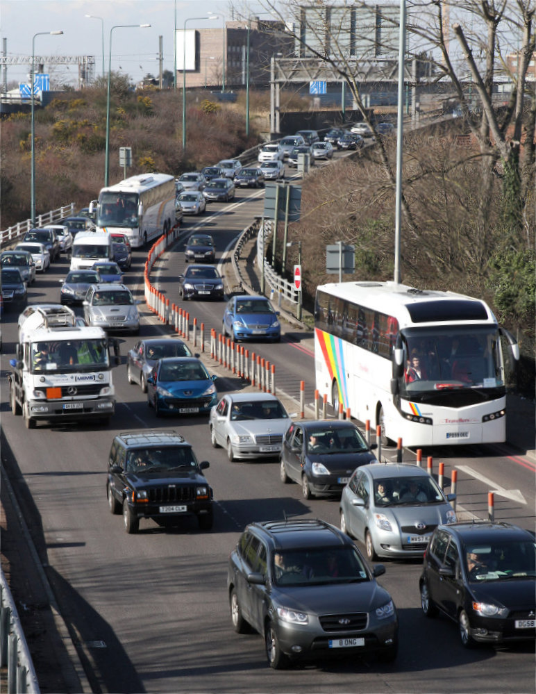
That all makes perfect sense, except that Staples Corner interchange was opened to traffic in 1977. In that year, any possibility of the motorway continuing any further south was long dead. Ringway 1 and the North Cross Route had been scrapped in 1973. So what were those carriageway stubs for?
Theories have been advanced that, in the late 1970s, there were hopes that the M1 could still be extended south, perhaps to reach the A40(M) Westway and the unfinished stub of the West Cross Route. No such plan has ever come to light, and the truth is rather more mundane.
Road projects take a long time to reach the construction stage. A typical motorway project might be 15 years in gestation before a spade ever hits the ground. And in the case of the M1 between Page Street and Staples Corner, present-day junctions 1 and 2, the design work was effectively completed in 1967 and orders were published in 1971, when the southern extension to Kilburn was still on the cards.
Delays followed, as they often do. When contracts could be let and construction could begin in 1975, the Ringways had been dead for two years, but changing course that late in the day is extremely difficult. Besides, the Greater London Development Plan had yet to be published, so no new policy had yet replaced the rejected Ringways.
Redesigning the project would mean re-running consultations and inquiries. The quickest way to get the road built was, therefore, to just build what was already designed, even if the design accounted for an extension that had since been scrapped.
So it was that, in 1977, the M1 opened with a set of stubs optimistically pointing at Kilburn, even though the motorway would never go there. They're still there today, one of London's easily-missed little monuments to a motorway network that never was.
Sources
- Planning during 1950s; aim to terminate at Marble Arch: MT 112/67; also referenced in British Road Federation, 1956. Urban Motorways: Report of the London Conference organised by the British Road Federation, 1956.. London: British Road Federation.
- M10/A6 to be improved to form link to R3; route, M10 and A6: MT 120/233.
- Route, M1, R1-R2; second alignment R1-R2 avoiding sidings: MT 106/437.
- Extension from Berrygrove to Hendon in two parts; name "Hendon Urban Motorway": LCC/CL/HIG/02/010; MT 118/72.
- Text from commemorative booklet: "Hendon Urban Motorway: Southern Extension of the M1", Ministry of Transport, 1967.
- Objections not heard; quote from Marples: MT 109/443.
- Route R1-R2 safeguarded 1965: MT 106/297.
- Staples Corner opened 1977 to plans made 1967: MT 118/235.
Picture credits
- Route map contains OS data © Crown copyright and database rights (2017) used under the terms of the Open Government Licence.
- Photographs of Brockley Interchange under construction, M1 at Edgware and M1 at Glendor Gardens are extracted from "Hendon Urban Motorway: Southern Extension of the M1", Ministry of Transport, Crown Copyright 1967; scans kindly provided by Mike Ashworth.
- Photograph of former M10 at St Albans is taken from an original by Lewis Clarke and used under this Creative Commons licence.
- Photograph of Midland Red coach on M1 appears courtesy of David Jones.
- Artist's impression of M1 at Cricklewood and engineering plan of M1 at Cricklewood Sidings are extracted from "North Cross Route: General Report", R. Travers Morgan and Partners, 1966.
- Photograph of queuing traffic at Staples Corner taken from an original by Martin Addison and used under this Creative Commons licence.