View east from Hill House Farm to Sandy Lane, 21 October 1996
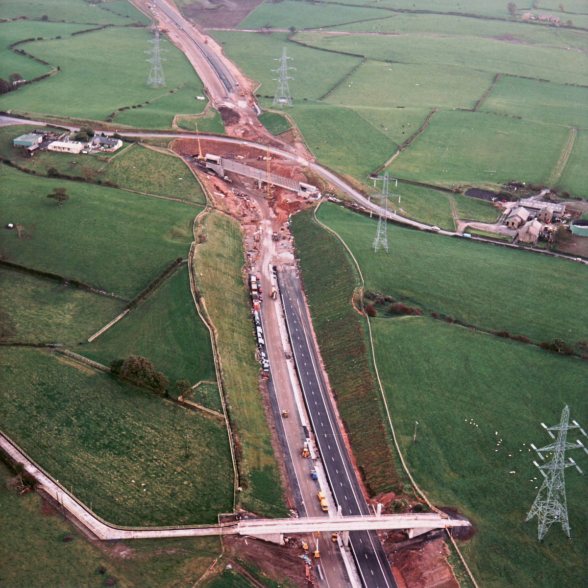
View east from Hill House Farm to Sandy Lane (see all photos of the same view)
Underneath Hill House Farm bridge, at the bottom of the picture, both carriageways have now been laid and completed, and both also have road markings. The one on the left, though, is in use as the haul road through the site, and very muddy. In the distance, Sandy Lane bridge has its spans in place but no deck yet.
Structure 16 (Sandy Lane overbridge)
Structure 16a (Hill House Farm overbridge)
What's new
The road that made no sense
It was the UK's only single-carriageway motorway, and twenty years ago it ceased to exist. This is the story of the strange fascination it held, and of my place in history.
The forever bottleneck, part 2
The second part of the story, where we learn why exactly the M4 gets narrower on the final approach to Europe’s biggest city.
The forever bottleneck, part 1
The M4 into London was one of the UK's earliest and most ambitious motorway projects. It was bold, pioneering... and almost instantly regretted.
Have you seen...
To the Limit
Speed limits are more emotive and divisive than almost anything else about the road network. How do you sort the fact from the opinion? And how did we end up with the speed limits we have?