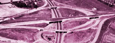
Opened nearly a decade after the first section, in the late 1960s, the south side forms the second phase of the Croydon Ring Road. It spans the Wandle valley, and so most of it is elevated above ground level on an extended flyover. In the middle it towers above surrounding streets, but it at each end the ground rises to meet it so there is no slope up or down for traffic using it.
Planners in the 1960s chose to join their huge new elevated road to the existing east side and the then-proposed west side of the ring road using a pair of roundabouts, a decision that looks a little odd today.
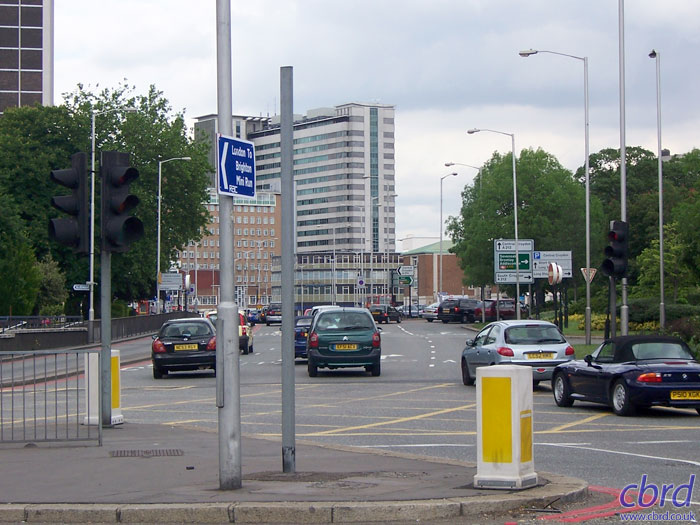
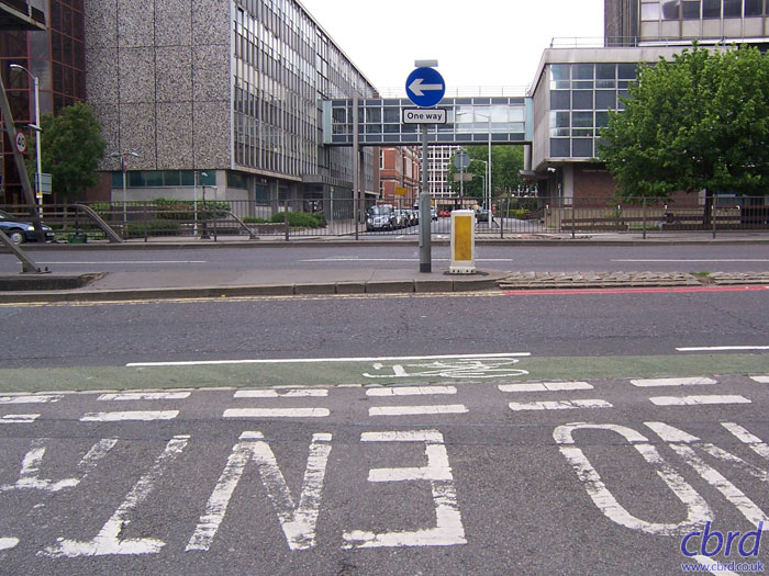
The roundabout near Fairfield Halls, where the east side of the ring road ends, is our starting point for the south side. This view is looking north along one side of the oval-shaped roundabout, towards the eastern side and Wellesley Road. The dual carriageway in the foreground, leading away to the left, is the south side of the ring.
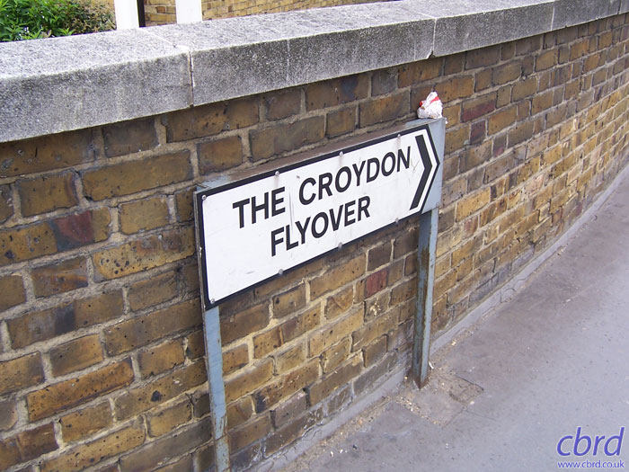
In other places, names on town centre relief roads commemorate local people or landmarks. Here, street name signs at the roundabout indicate that Croydon's town planners took a very literal line when it came to naming the new flyover in Croydon. They called it The Croydon Flyover. That's some Friday afternoon decision-making if ever I saw it.
Heading west along the route, not long after the roundabout. The first junction is a pair of east-facing sliproads that run down to the High Street. To the left is an entrance from the one-way Edridge Road.
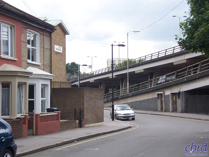
A look northwards out of Edridge Road shows how this surface-level dual carriageway sliced through the existing pattern of streets. Fell Road is opposite, but is inaccessible from here. There is also no access to the flyover.
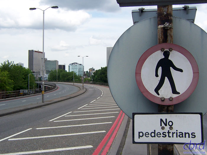
The exit sliproad to the High Street drops away sharply, but it is simply following the natural ground level. The Flyover stays almost level throughout its length. While The Croydon Flyover got a new name, its sliproads take the names of streets that were cleared to make way for it. This one is called Edridge Road.
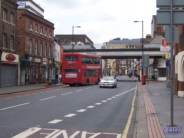
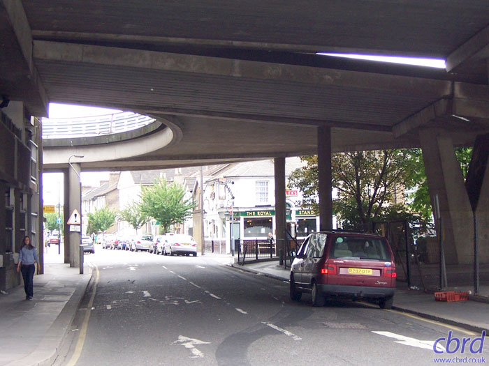
Down below, a look northwards up the High Street towards Croydon town centre. While the road here is still named High Street, it's not really part of the central shopping area, but even so, the flyover is very intrusive in a low-rise street environment. The restaurant underneath it to the right is called "Il Ponte" - literally "the bridge" in Italian.
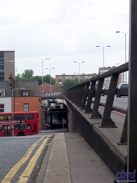
Up above, two lanes each way stay level and, in the distance, actually drop down a little way as they cross a steep valley. This part of South London is a little hillier than most.
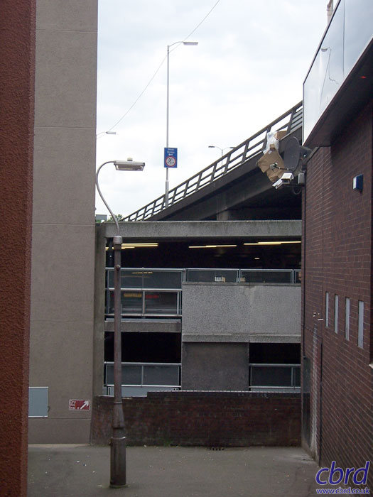
This little alleyway off the High Street shows just how inviting this part of town looks these days. Immediately in front is a multi-storey car park, which fills up some of the space underneath the flyover and also rises several storeys above it to the south.
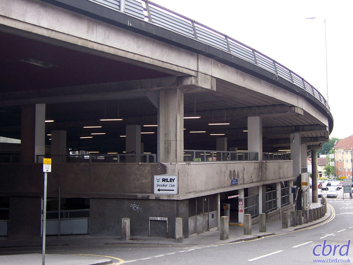
Another look at the multi-storey car park extending under the flyover. This is a much better solution than leaving the space open, as often the area underneath an elevated road is left undeveloped and becomes very unpleasant. This car park is not very attractive, but at least the space is being used for something worthwhile.
Looking south, underneath the flyover on Wandle Road. This street is lined with terraced houses on both sides, but there is a huge gap in the middle where the whole street is effectively roofed over by the flyover, a sliproad on each side heading for the Duppas Hill Roundabout, and at the far side, a looped entry point directly from the flyover to the multi-storey car park.
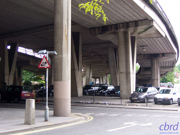
To the west of Wandle Road the space under the flyover is open, with a surface car park underneath. The arrangement of a high flyover with two descending sliproads at each side make this difficult to develop, though light industrial units could be placed here to stop the place feeling so neglected and empty.
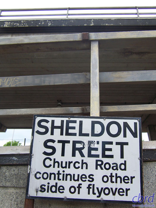
Sheldon Street runs parallel to the flyover on its south side. Once it was a typical street of Victorian terraces, like the ones on the left, but one side was demolished for the car park, and ahead it has been diverted to the left to avoid the new road. Now it's not such a quiet place to live.
Church Road is another surface street that has been bisected by the flyover. At this point, the Croydon Flyover itself is high up above and isn't an obstacle, but to either side the sliproads heading for Duppas Hill Roundabout are nearly at ground level.
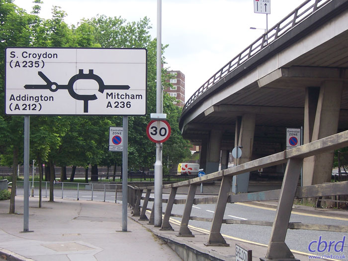
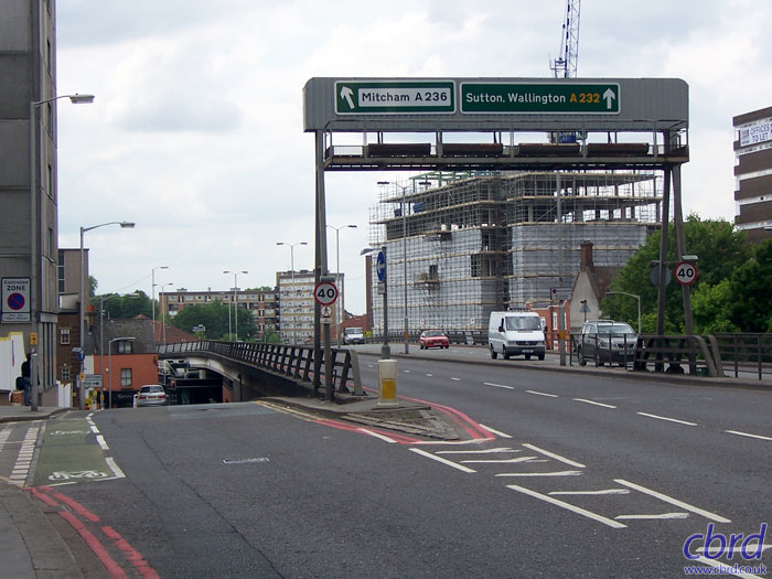
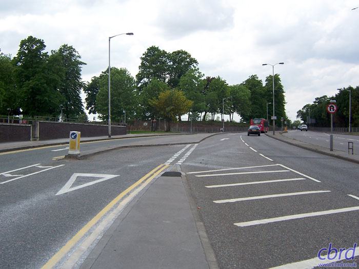
A look along the westbound off-slip, showing the three important local roads that meet here. To the right, the A236 towards Mitcham is actually the west side of the ring road, but again it's not signposted, and again it is not continuous or free-flowing in any way, despite the heavy engineering present here. The two east-facing sliproads here are called Pump Pail North and Pump Pail South respectively.
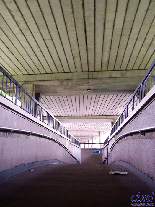
Pedestrians can't cross the roundabout on the level, and are instead sent through some typically sixties subways and underpasses.
Back up on top, looking east towards Croydon again. The roundabout is beneath the left-hand curve visible here. Most of the other roads here still have orange sodium lights, but the high-pressure white lighting on the flyover itself was installed at the expense of a production company shooting a film set in London, who required better lighting for a shot of Bill Murray driving at night.
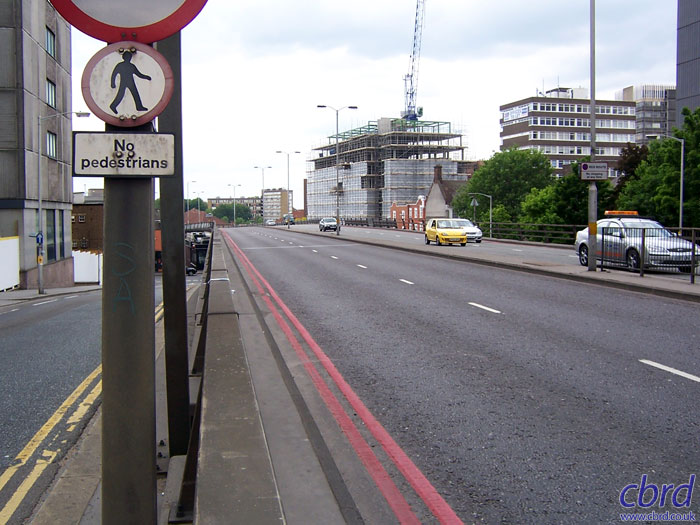
Facing the other way from the same point, it's now clear why one lane was hatched out over the flyover. The dual carriageway ends abruptly here, so the sliproad merge has been reconfigured to give a left-turn into a side road and a give-way line on to the A232. Land was reserved to continue the dual carriageway through to the A23 but this work was never done. And to complete the list, the sliproads at this side of the roundabout are called Davenant Road and Duppas Hill Lane.