Croydon Ring Road:
Route map

To help orient the lost traveller who is not yet familiar with this part of South London, here is the full glory of the Croydon Ring Road, such as it is, in stylised map format.

This diagram includes the various odd concessions to the Croydon Tramlink system and the very numerous places that traffic stops at traffic signals, despite the various flyovers and underpasses on the way.
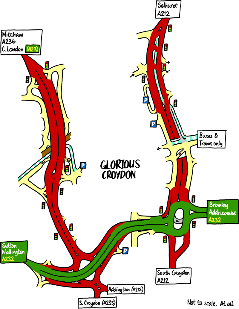
The Croydon Ring Road. Click to enlarge
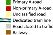
Key of symbols used on the map

In this section

What's new

The road that made no sense

It was the UK's only single-carriageway motorway, and twenty years ago it ceased to exist. This is the story of the strange fascination it held, and of my place in history.

The forever bottleneck, part 2

The second part of the story, where we learn why exactly the M4 gets narrower on the final approach to Europe’s biggest city.

The forever bottleneck, part 1

The M4 into London was one of the UK's earliest and most ambitious motorway projects. It was bold, pioneering... and almost instantly regretted.

Share this page

Have you seen...

Abbreviations

How do you describe a road? One way is to use these engineering abbreviations, much loved by the UK's community of road enthusiasts.

About this page

Published

Last updated