The rest of the A82
It is reasonable to state that few sections of the 175-mile long A82 meet modern design standards. The generally stated figure is 19 out of 147 miles to the north of Balloch, 75% of which occur in the 16 miles to Tarbet! Much of the route out of Glasgow is constrained by the urban landscape surrounding it, especially on the Dumbarton section. This also suffers from the geography of the steeply sloping Clyde valley. The dual carriageway of the Alexandria bypass is the first fast-flowing section of road bearing the A82 tag, and the dozen miles north of it to Tarbet also, superficially, meet modern standards. However, the sightlines, bends and gradients make overtaking near impossible, producing long trains of cars queued up behind lorries.
The section from Tarbet to Crianlarich is a national disgrace, where an average of 40mph is good going, but a major campaign and recent government assurances suggest that this may be rectified in the next 5-10 years.
The five miles from Crianlarich to Tyndrum suffer the same issues regarding overtaking as further south, but then the road opens up and after climbing out of Tyndrum, numerous long straights mean that progress is rarely hindered before reaching the speed limits of Glencoe village.
Between Glasgow and Crianlarich there is little evidence of previous routes north as you travel along the A82. Along Loch Lomondside this is probably down to - north of Tarbert - the road still being that constructed in the early 19th Century and - south of Tarbert - the successful planting of thousands of trees, hiding almost any view. However, if you were to leave the car and follow the cycle track, you will find that much of the old road is still there, providing access to properties or a scenic lochside path. Some sections are still accessible by car, but are generally poorly signed as such.

After passing through Glencoe and crossing the Ballachulish Bridge (1975), the road weaves its way between the houses and hotels of the villages of North Ballachulish and Onich, before returning to a narrow twisty route along the shore of Loch Linnhe.
This section of road allegedly produces the most accicdents, as it is easy for cars to average over sixty between Corran and Fort William (speaking from experience in a diesel Land Rover Discovery). However, in the summer, lorries, motorhomes and tourist coaches can reduce the speed to 30mph, while in the winter regular maintenance programmes see numerous roadworks. All this leads to a lot of frustration amongst drivers who know the road, who then attempt rash overtaking manouveres. There are probably far more near misses than anyone would ever guess.
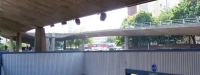
After passing through the urban sprawl of Fort William (shown left; click to enlarge), the road north again suffers from a combination of fast-flowing wide sections with good visibility connected by a series of narrow twisty bends as the road navigates the contours of the lochsides. Ironically, as the road winds its way along Loch Ness's northwestern shore, the original military road on the southeastern shore is far straighter and leveller (if narrower) route, and can actually provide a significantly quicker journey to or from Inverness.
Further south, at Loch Oich, the military road also passed on the opposite shore to the modern road, but in both instances this can easily be explained.
The Geography of the Great Glen provides a southeast side which is almost straight to the north of Glen Spean, while to the northwest it is heavily indented by a series of Glens running west - Glen Garry, Glen Moriston and Glen Urquhart. All three of these indents are the site of settlements, and more importantly junctions for trunk roads running to the west. The military road had no interest in such matters, simply connecting the forts of Inverlochy, Fort Augustus and Inverness (then Fort George) together.
Other routes
The A82 is just the most conspicuous route where more than one road alignment can be found. Throughout the north and west of Scotland, modern roads (some still being built) take on new courses across the wild moorlands of the Highlands. The new road between Arisaig and Mallaig is one prime example, cutting across the moor a mile to the east of the old road that winds its way along the shore. Further north, the new road from Glengarry to Bunloyne was built when the reservoirs flooded the old route from Tomdoun to Cluanie Inn in the 1950s. The A836 and A838 along the north coast also shows sections of the older road running alongside the modern route.
On the Ardnamurchan peninsula, the authorities of the 1960s went one better, constructing a completely new road from Inverailort through Roshven and Glenuig to Kinlochmoidart. Opened in 1966, this provided an alternative route to Acharacle and points west, and has become an invaluable route for the economy and population of this remote area. Other roads on the peninsula - linking Corran to Strontian and Lochaline - also show old alignments running through the heather to one side. These new roads were mostly built between 1960 and 1980.

Returning to Telford, the road surveyed by his team from Fort William west to Arisaig is another example of three parallel routes. This road (the A830) has been almost completely renewed from The Princes Cairn on Loch nan Uamh through to Arisaig in 2008/9. As the new road has been opened, the old route has been variously left as access drives, grubbed up to leave just a footpath and cycletrack, or removed completely and turfed over.
For the eastern half, this is probably the removal of Telford's road, but to the west of the Druimindarroch turning Telford's road continues due west where the more modern routes turn northwest to follow the railway line. This older route cuts through the small glen that emerges on the coast of Loch nan Ceall about 1.2 km (¾ mile) south of Arisaig village. Along its route a variety of bridges can be seen, and there are several places where retaining walls have been built to hold back the stream which flows alongside. As this road has been no more than a farm track for seventy years or so, it is an interesting study of one of the earliest of Telford's roads, completed in 1806.

While these are far more modern examples of road re-alignments, as with the A82 it is a practice dating back nearly two hundred and fifty years. Few of the original military roads were still serviceable by 1800. Some had completely sunk into the bogs of the moorland that they crossed. So when Telford carried out his surveys, even where a military road existed, it was rare for him to follow its course. Some sections may have been used - as at Ba Bridge on Rannoch Moor - where the old road provided some kind of firm base to cross the peatbog, but it was often these very sections where the road had vanished most completely.